Itinerary map
The route at a glance
© OpenStreetMap contributors
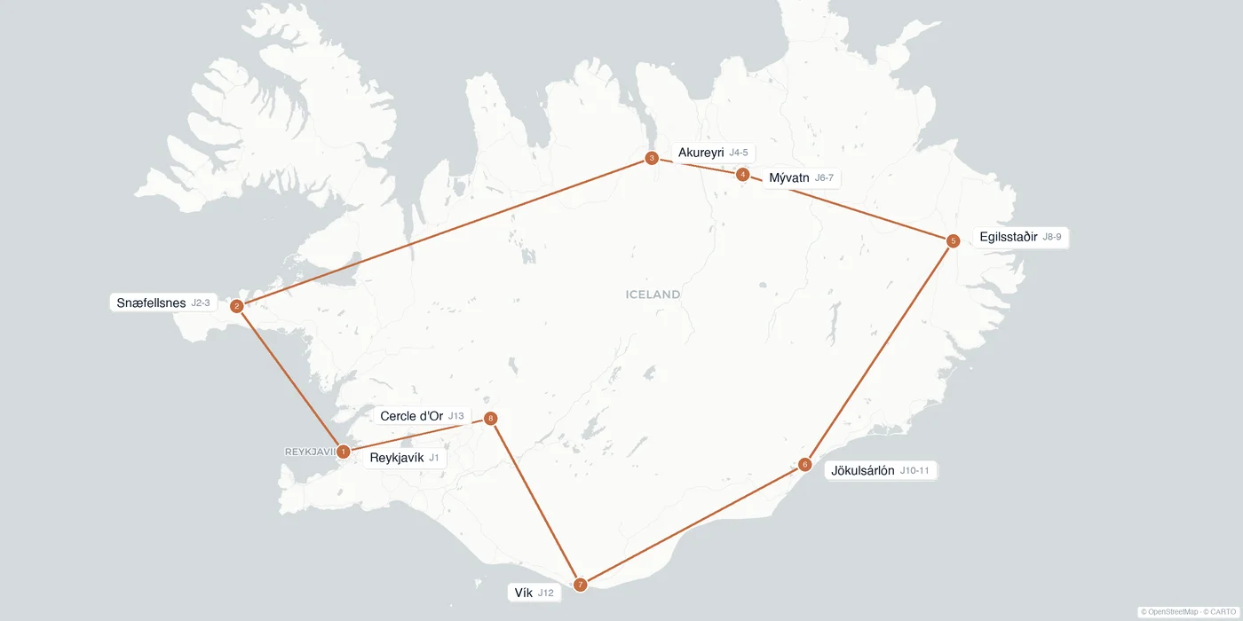
14 days to loop Route 1: Snæfellsnes, the North, Mývatn, the eastern fjords, the south coast and the Golden Circle. Detailed budget, driving tips and options.
🔄 Updated June 1, 2026
In brief
Duration
14 days
Stops
8 zones
Average budget
€2,600-3,800
Total distance
~2,400 km
Profile
Full road trip
Season
Jun-Aug
Reykjavík 1d · Snæfellsnes 2d · Akureyri 2d · Mývatn 2d · East 2d · South-East 2d · Vík 1d · Golden Circle 2d
Itinerary map
© OpenStreetMap contributors
Detailed program
~€90/pers
~€80
~€70
~€85
~€90
~€75
~€70
~€80
~€70
~€90
~€85
~€75
~€80
Flight
How much
Backpacker
€2,600
per person
Comfort
€3,300
per person
Premium
€5,800
per person
Shorter, longer
1 week
The essential South and the Golden Circle.
2 weeks
The full island loop on Route 1.
1 month
Ring Road, the Westfjords and the Highlands.
How to get around
This itinerary loops Route 1 clockwise, that is ~1,322 km of loop plus the detours (Snæfellsnes, fjords). All by car, no flight or ferry. An SUV is recommended for comfort on the long northern and eastern legs.
Rental SUV
€1,100-1,800 for 14 d · more comfortable than a compact over time
Fuel and km tax
~€2/litre · 2,400 km to plan, plus the 2026 kilometre tax
Route 1 (Ring Road)
Paved all the way round · road.is for live conditions
Adapt by season
Summer (June to August) is the only truly comfortable season to loop Route 1: all sections are open, the midnight sun stretches the days and the North and East lodgings are accessible. In winter, the full loop is possible but risky: snowstorms, mountain-pass closures (route 939, Öxi) and 4-5 hour days. Check road.is and vedur.is each morning, and plan a 4x4 and buffer days in the cold season.
Author tips
✅ Would redo
⚠️ Would change
FAQ
Marie Laurent ✓
·Southeast Asia specialist · itinerary personally tested.
Last updated: June 1, 2026.